World's First SyncFused OptoSAR Earth Observation Satellite
Engineered to end the compromise between all-weather visibility and intuitive clarity.
A New Era in Satellite Intelligence
This is the foundation for a future where high-quality satellite imagery is as accessible as any dependable, everyday utility.
MISSION
DRISHTI
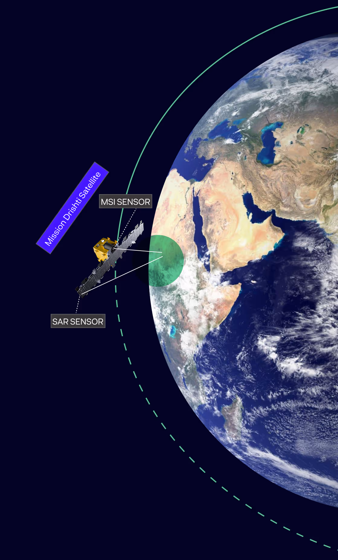
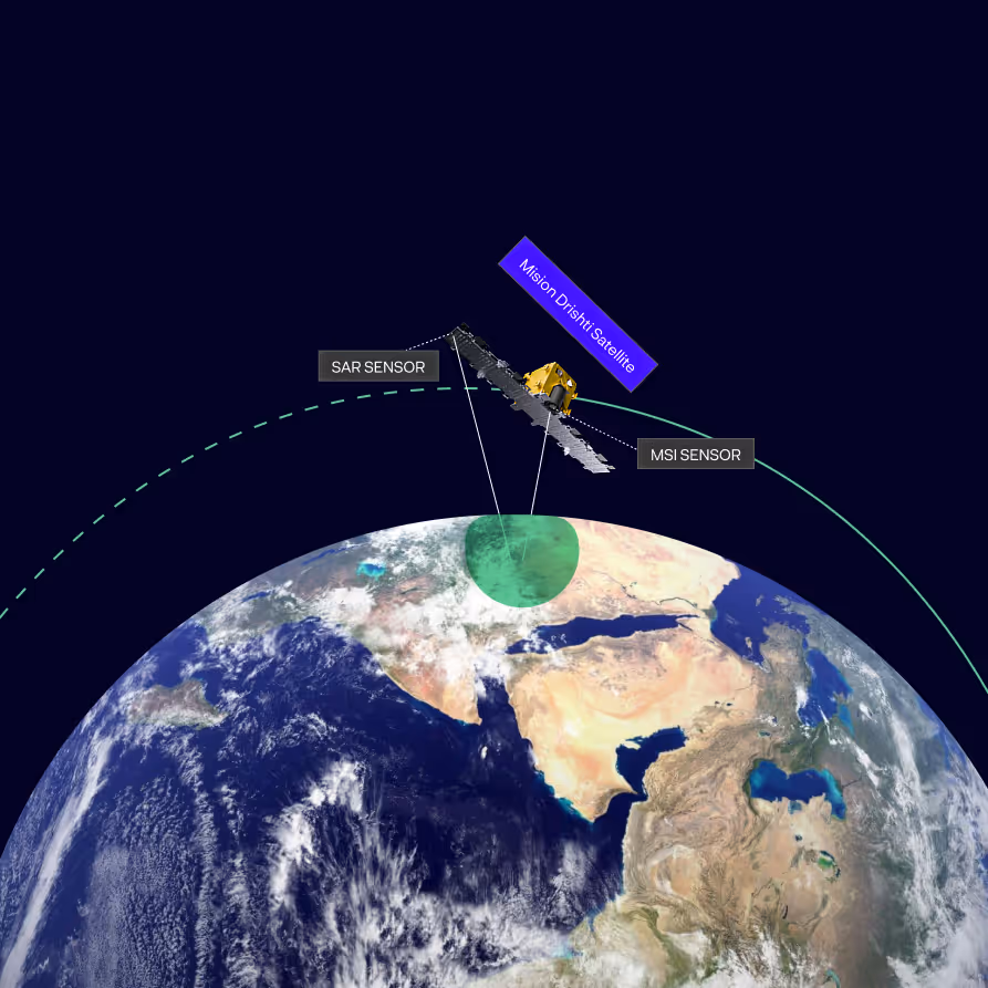
Our satellite, Mission Drishti, is the world’s first to carry both SAR and MSI sensors on a single platform.
Combining optical clarity with all-weather SAR strength, Mission Drishti provides a stable, standardized foundation for developers, enterprises, and resellers to build long-term solutions. Syncfused with OptoSAR imagery isn’t just more data; it’s a platform for new products, new workflows, and entirely new use cases.


The SyncFusion™ Advantage: Two Sensors, One Platform
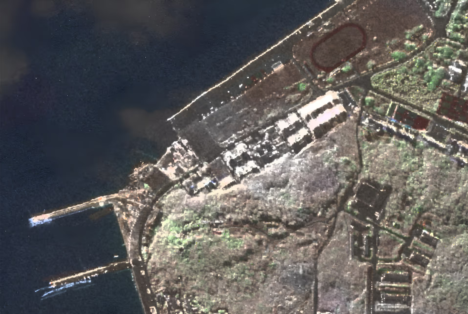
Mission Drishti's primary innovation is its SyncFusion™ [or SyncFused OptoSAR] payload, which co-locates a high-resolution SAR sensor and a 7-band multispectral imager on a single satellite. This is the world's first commercial multi-sensor satellite combining SAR and MSI.
By capturing both data streams in a single pass, we eliminate the need for data fusion from separate sources, delivering an inherently aligned, analysis-ready product with three times more information than a standalone sensor.
What Mission Drishti Enables

Assured Mission Reliability
Never let cloud cover or darkness dictate your operational timeline. Our SyncFused sensor approach guarantees you can acquire critical imagery when you need it most, providing an uninterrupted stream of intelligence for time-sensitive missions.

Unparalleled Contextual Intelligence
Move beyond pixels to true understanding. Syncfused OptoSAR images allow you to identify objects and detect changes with a level of confidence that a single sensor cannot provide.

Accelerated and Simplified AI Training
Training AI models on SAR alone is tough. Our fused imagery offers intuitive visual clarity that speeds up dataset labeling and slashes model development time and cost for ATR and change detection.
Mission Drishti Payload Specifications


Synthetic Aperture Radar enabling the all weather, day and night imaging capability for Mission Drishti.
High efficiency Photovoltaic panels ensuring sustained power generation.
Precisely engineered separation ring that ensures safe and reliable satellite deployment into orbit with a minimum tip off rate.
High precision star tracking ensuring exceptional attitude control and pin point satellite orientation for accurate imaging.
High gain communication antennas enabling seamless data downlink and real time connectivity.
Multi-Spectral Imaging payload capturing rich spectral data across multiple bands.
MSI: 10 km
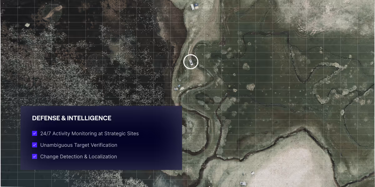
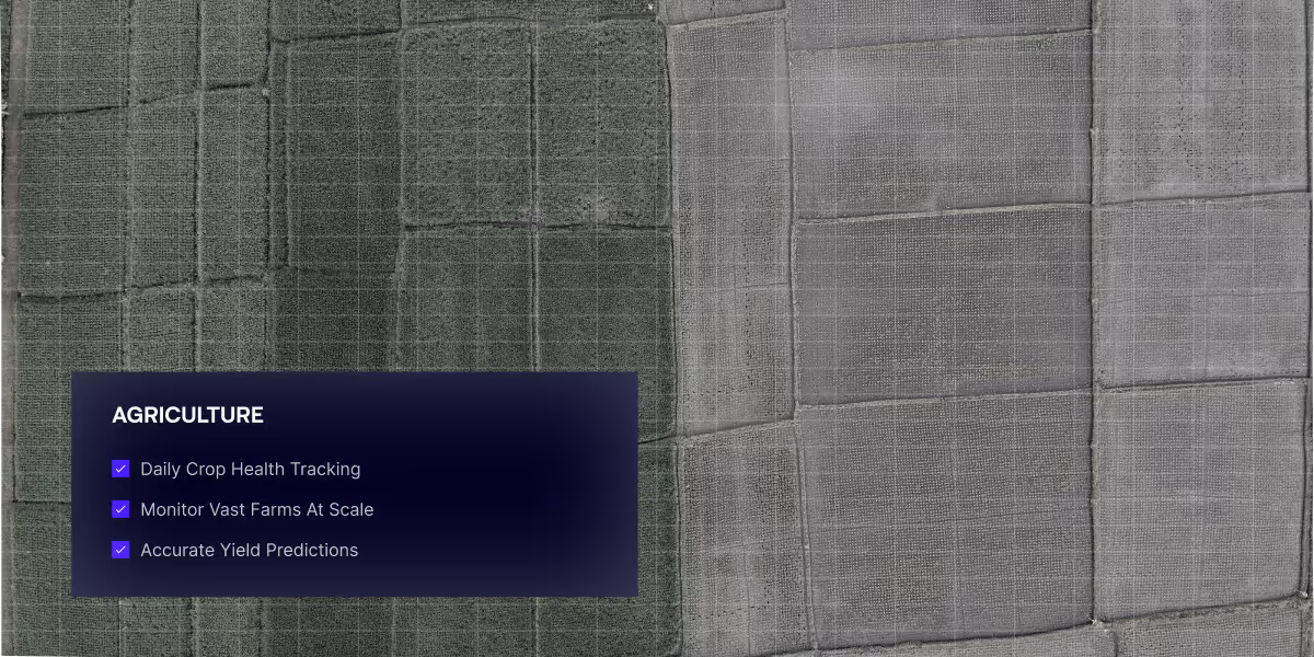
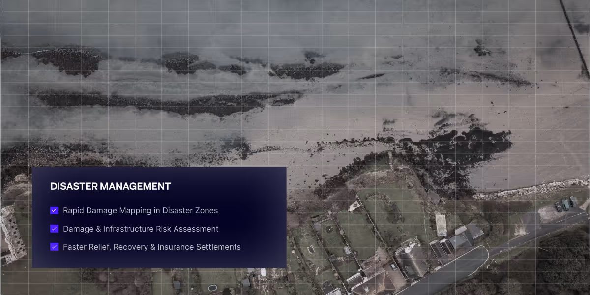
Pioneering Solutions Across Sectors
Mission Drishti has a range of applications across defence, infrastructure monitoring, agriculture and more!


A New Vision For Earth
Discover the technology behind the world’s first satellite that fuses all-weather visibility with intuitive clarity.