The Tech Behind OptoSAR Imagery
We are solving one of Earth Observation's most fundamental challenges.


The Problem of Parallax and Time-Gaps
Traditionally, creating a multi-layered analysis required data from two separate satellites: one with a SAR sensor and one with an optical sensor. This approach introduces unavoidable errors from differences in viewing angle (parallax) and capture time (temporal gaps). For mission-critical applications, this level of uncertainty is unacceptable.
The SyncFusion™ Technology Stack
OptoSAR is more than just sensors; it's an end-to-end system of hardware and software designed to work in perfect harmony.
Hardware Integration
AI-Powered Fusion Algorithms
The Problem of Parallax and Time-Gaps
Traditionally, creating a multi-layered analysis required data from two separate satellites: one with a SAR sensor and one with an optical sensor. This approach introduces unavoidable errors from differences in viewing angle (parallax) and capture time (temporal gaps). For mission-critical applications, this level of uncertainty is unacceptable.

The SyncFusion™ Technology Stack
OptoSAR is more than just sensors; it's an end-to-end system of hardware and software designed to work in perfect harmony.
Hardware Integration

AI-Powered Fusion Algorithms

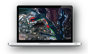
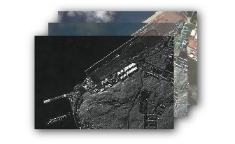
Anatomy of a GalaxEye OptoSAR Image
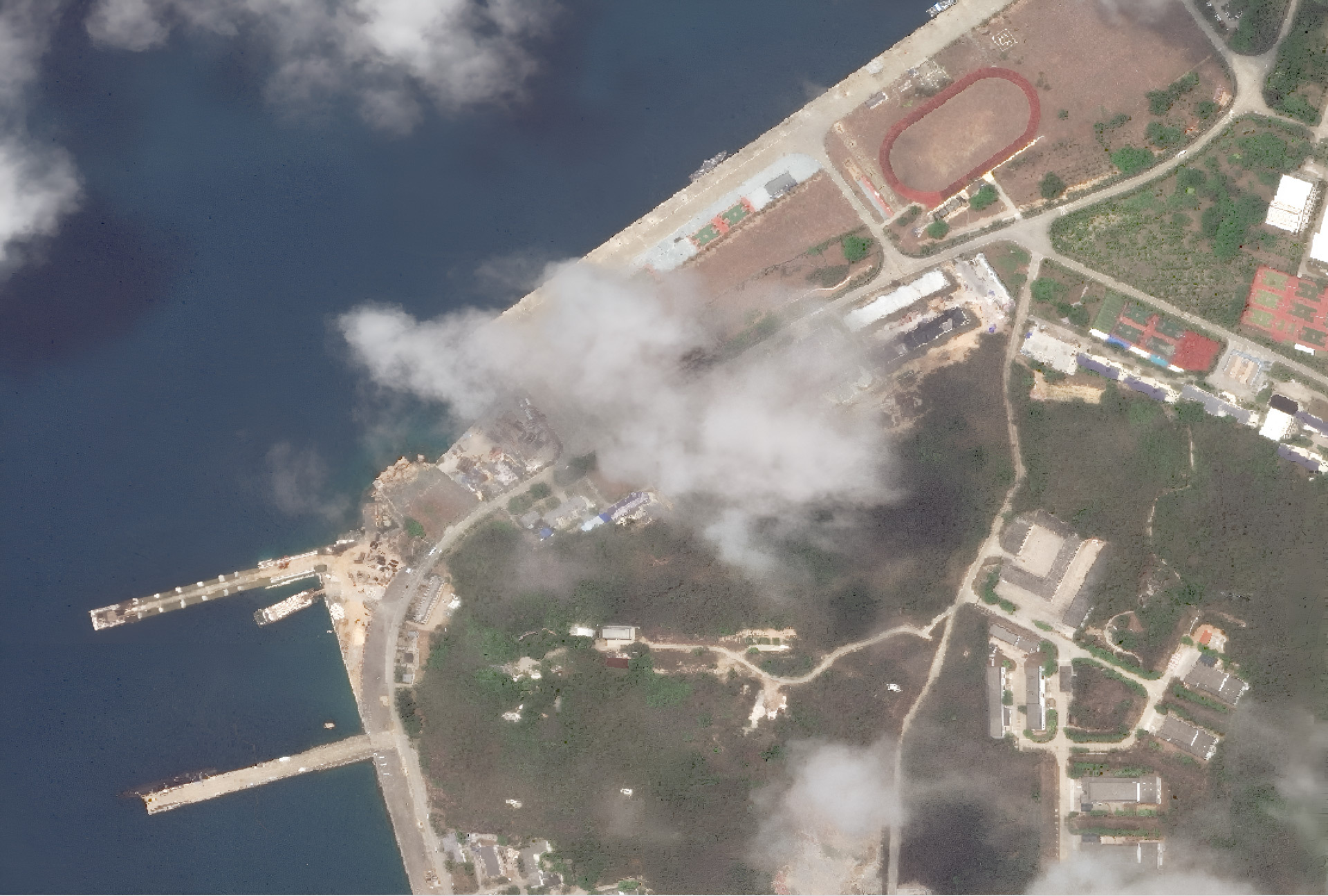

The Optical Layer
Provides intuitive visual context, color, and texture, making the image easy to interpret. But it is obscured by nights, clouds and smoke.
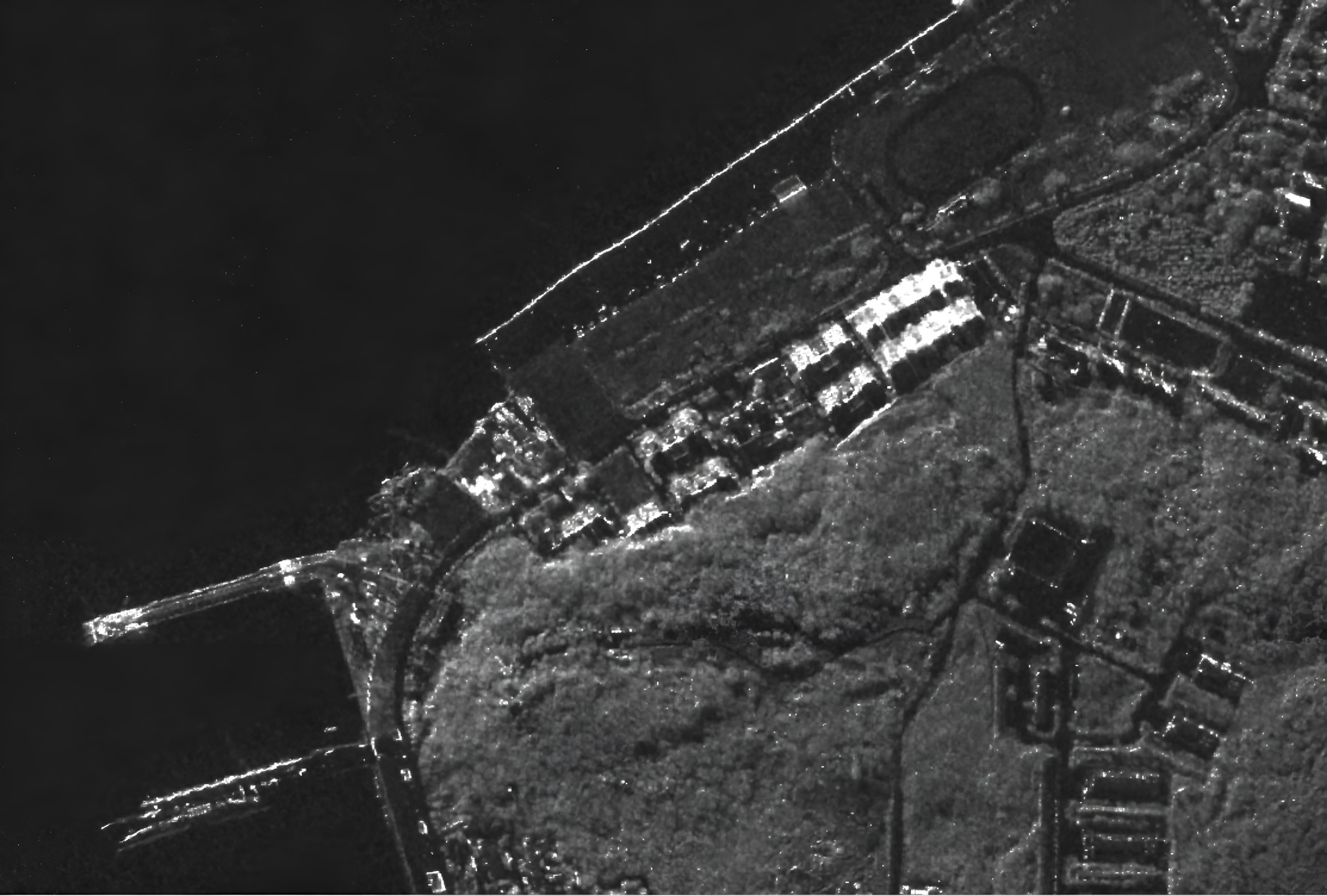
The SAR Layer
Penetrates clouds, darkness, and smoke to reveal structural information, surface texture, and elevation changes. But it's very unintuitive.
The OptoSAR Image
Combines the clarity of Optical Imaging with the all-weather reliability of SAR. The result is one dataset with complete context and undeniable ground truth, delivered from a single pass.
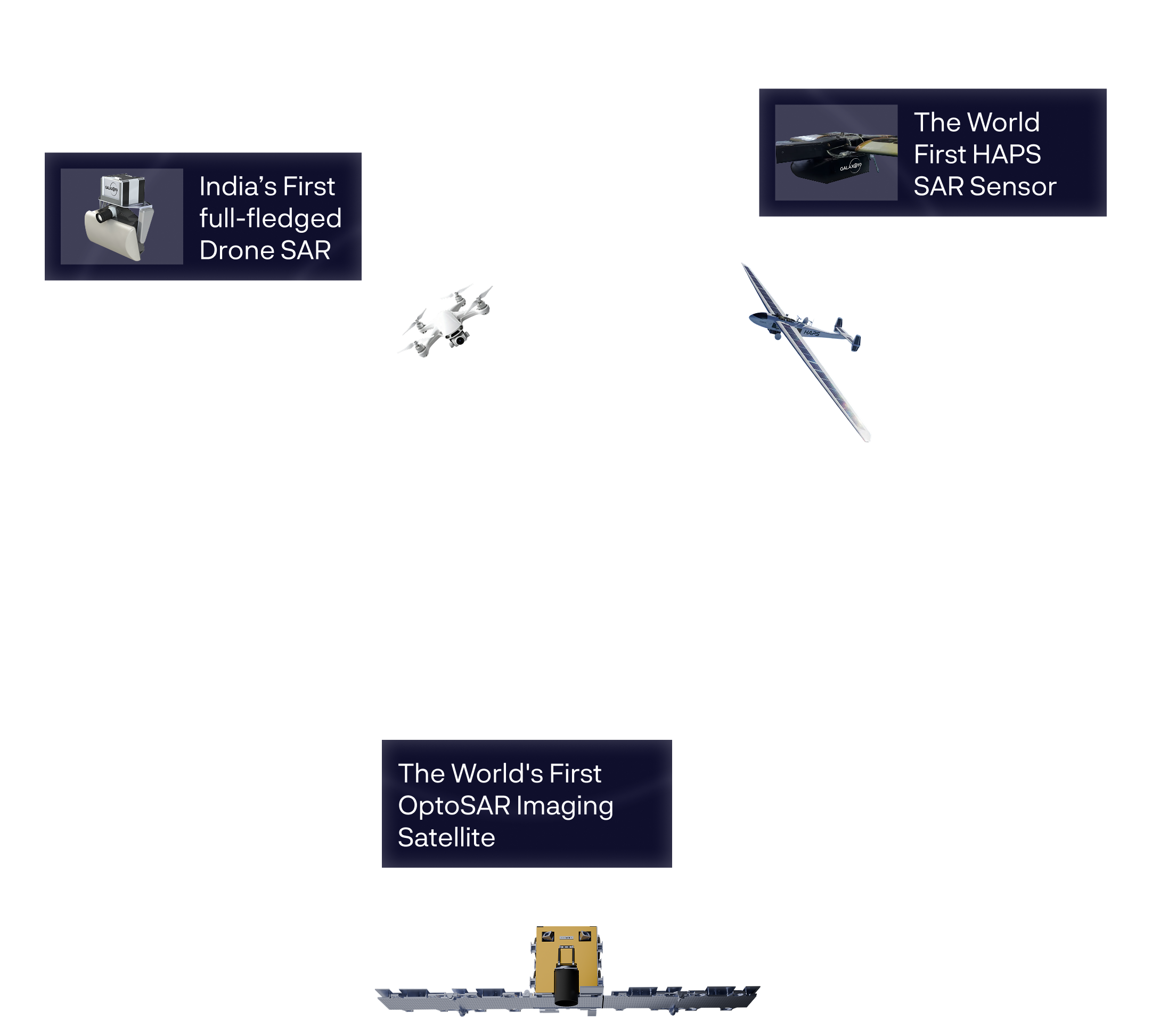
Our entire stack is designed and built in-house.
We validated our sensors across drones, aircraft, and HAPS platforms, with 400+ test flights and live trials with defence and research bodies.
In House Processing